LASER SCANNING SERVICE IN FLORIDA
LASER SCANNING SERVICE IN FLORIDA
Call us at (321) 415-4385
Get your project done accurately, efficiently, and without the headaches
Trust in AMAS Architecture to deliver the best and most accurate measurements for your building or project with our state of the art technology and years of experience
Get your project done accurately, efficiently, and without the headaches
AMAS Architecture delivers the best and most accurate measurements for your building or project with our state of the art technology and years of experience
Receive an as-built REVIT model
Our in-house licensed architect will scan your project and provide you with a point cloud file with panoramic views so you can easily access the project and share among your team members.
Reliable and Efficient Laser Scanning Service in Florida by Licensed Architect
What is Laser Scanning?
At AMAS Architecture, we use laser scanning technology to provide precise and detailed 3D representations of buildings or objects.
Laser scanning, also known as 3D laser surveying, involves using specialized equipment to emit laser beams that capture the exact dimensions and features of a building or site. This data is then processed to create highly accurate 3D models, which can be used for various architectural, design and construction purposes.
How is it done?
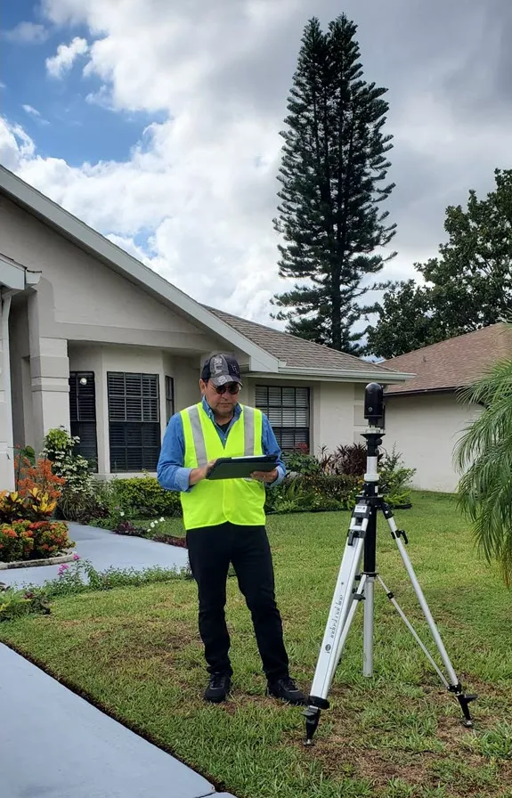
The laser scanning process begins with our team setting up a laser scanner at strategic points around the site. Our Leica BLK360 g2 scanner uses LIDAR technology to determine distances. As it rotates 360 degrees over approximately 20 seconds, it captures up to 680,000 points per second.
Who will carry out my scan?
Licensed architect Alfredo Medina, with over 20 years experience in architecture, will be carrying out your project.
LASER SCANNING
When do you need Laser Scanning services?
RESIDENTIAL PROJECTS
If you have a property that does not have existing drawings (or they are deteriorated/outdated) and you need them to start a new project or modification.
REAL ESTATE
If you need to show the current condition of a property to a potential buyer, preserve the condition of a historic building or object or if you need to record the status of an accident, damage or collapse.
COMMERCIAL PROPERTY
Speed up your architectural project with laser scanning. Ditch the pencil and paper and replace multiple days mapping out a property with our laser scanning service.
Our Projects
We are available to scan your project right away. From residential buildings to commercial, our complete laser scanning service allows you the ease of convenience, precision and efficiency.
Reliable and Efficient Laser Scanning Service in Florida by Licensed Architect
What is Laser Scanning?
At AMAS Architecture, we use laser scanning technology to provide precise and detailed 3D representations of buildings or objects.
Laser scanning, also known as 3D laser surveying, involves using specialized equipment to emit laser beams that capture the exact dimensions and features of a building or site. This data is then processed to create highly accurate 3D models, which can be used for various architectural and construction purposes.
How is it done?
The laser scanning process begins with our team setting up a laser scanner at strategic points around the site. Our Leica BLK360 g2 scanner uses LIDAR technology to determine distances. As it rotates 360 degrees over approximately 20 seconds, it captures up to 680,000 points per second.
Who will carry out my scan?
Licensed architect Alfredo Medina, with over 20 years experience in architecture, will be carrying out your project.
Our Process
Here's a step by step of how we carry out our laser scanning service
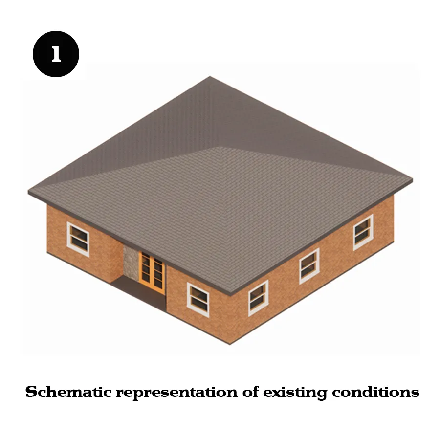
STEP 1
Scanning Set Up
Using a laser scanning device, we scan the building or object. The laser device captures the position and appearance of all visible elements.
The number of “setups” or scans depends on the list of requirements from the client. That’s why you need to specify if you need just the interior from floor to ceiling, or more.
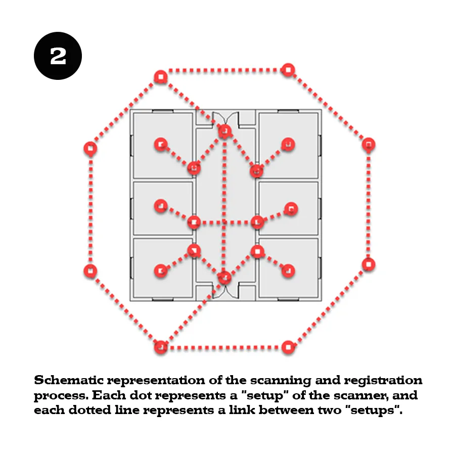
STEP 2
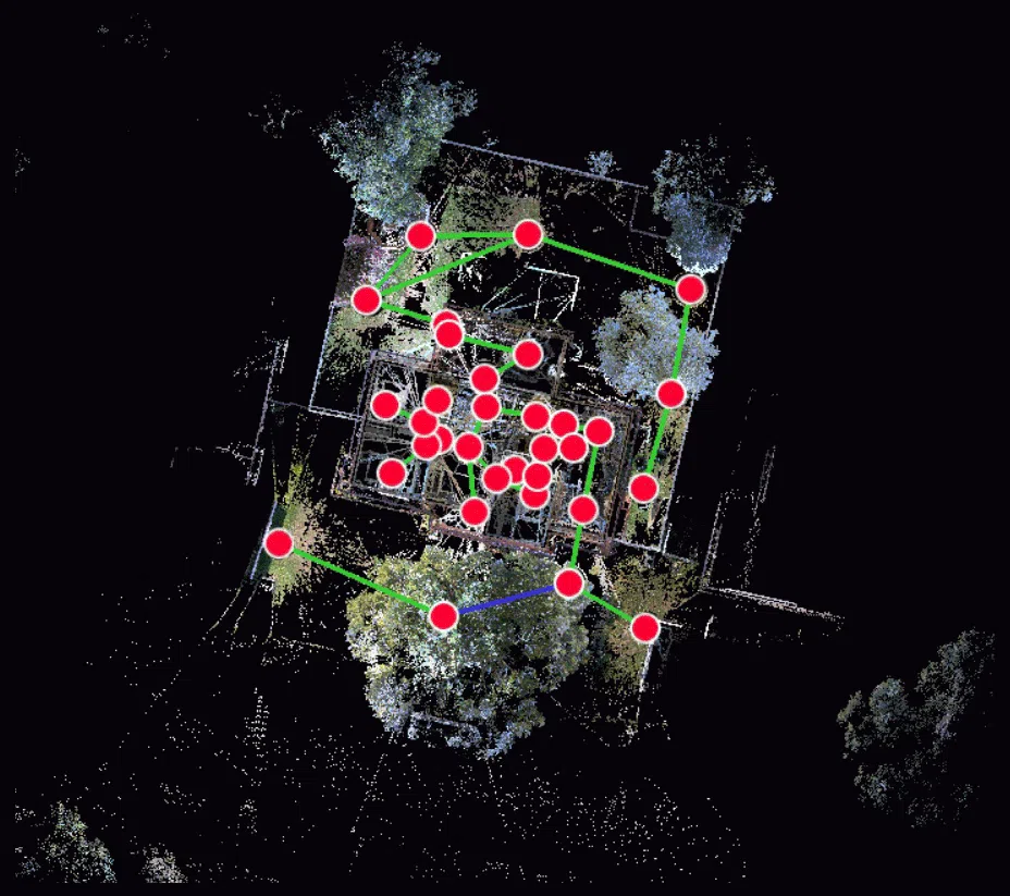
Registration
This step is like putting together a puzzle, made of all the “setups” or scans that the laser scanning device took at the property. The goal of this process is to merge all the data correctly to produce one single file, known as the “point cloud”.
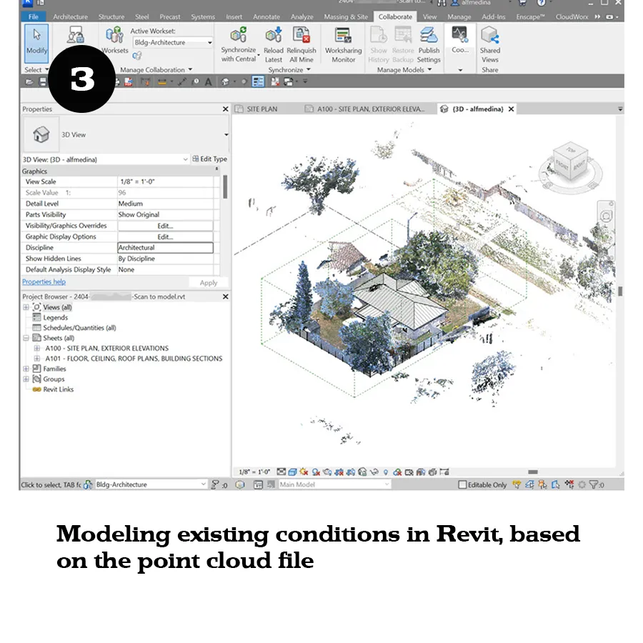
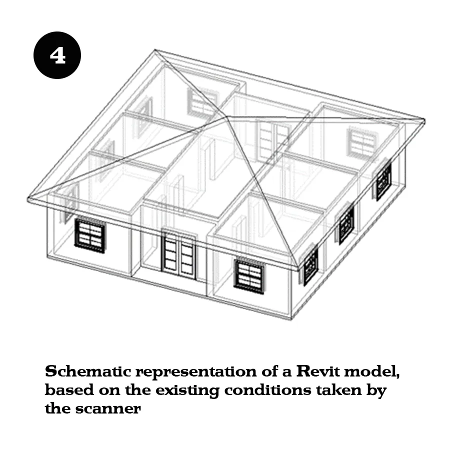
STEP 3
Modeling
Using Autodesk Revit plus an add-in, we model the existing conditions based on the point cloud file. Then we create architectural views, based on the list of drawings that you requested.

Our Expert

Alfredo Medina
Licensed Architect
Connect with me on LinkedIn
Alfredo Medina is a licensed architect in Florida. Before starting his own practice, Alfredo worked for architectural firms in New Jersey and Florida (Miami and Orlando), and contributed to the design and production of different project types such as educational, residential, entertainment, and assembly.
Using his expertise on technology applied to architecture, Alfredo worked on two large entertainment projects as a BIM Manager. First, working for Universal Creative on the Universal Beijing Resort project, and then working for HHCP Architects, on the Epic Universe Theme Park in Orlando.
Since April 2023, Alfredo has been practicing architecture independently in Orlando, working on single-family residential, building permits, daycare, and agricultural-agritourism projects, among others.
In April 2024, after acquiring up-to-date hardware, software, and undergoing extensive training, Alfredo began offering laser-scanning services in central Florida, as a hands-on, independent service provider, who does the scanning, registration and modeling until delivering the information package that the client needs.
As a licensed architect, former BIM Manager, and a laser-scanning provider, Alfredo understands how to obtain, organize, and present the existing conditions of a building or object with precision, completeness, and accuracy.
CONTACT US
Reach Out
Our licensed architect, Alfredo Medina, is available to help you solve your architectural needs with a variety of services, including Laser Scanning with point cloud systems.
Office: Orlando, FL
Call: (321) 415-4385